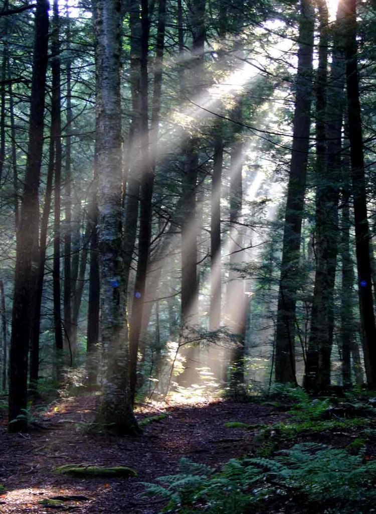
Along the Blue Hill Trail.....

Date - July 29, 2006
Destination - Pharaoh Lake, Essex County, NY
As I normally head into the Southern Adirondacks, this trip has given me a renewed appreciation for the beauty and solitude of this region's Eastern areas. It was a bit after dawn when, passing Exit 25 of the Northway, I started down into the valley that the Schroon River flows through as it leaves the lake by the same name. Only the tops of the mountains and hills were visible through the morning fog. For a few short minutes it felt like I was transported into another world, looking across a sea with islands in the distance.
My hike started at a trailhead on the South side Rte 74, across the road from Paradox lake. This is called the Blue Hill Trail. It is 3 miles long and ends at the dirt access road going to Crane Pond. Though it would be easier to drive directly to Crane to start the hike, this trail is so "pure Adirondack" that it is well worth the time and energy to travel in this way. Much of the trail is through woods that are open enough to be able to see well ahead and around you, making for some very good photo opportunities.

There were more Red Efts (the terrestial form of the Red Spotted Newt) on this trail than I have ever seen anywhere before, in fact I had to be careful in spots not to step on them.

The fungi in the photos I think is called White Coral, though I could be wrong as my mushroom guide does not have an illustration of this variety.

About 1/2 way along the Blue Hill Trail there is an unnamed marsh/pond that the trail takes you around, and when I was coming out at the end of the day there was a work party rebuilding on of the rustic log bridges. Also, there is a couple of hundred feet of elevation change which you will be going up when heading North on this trail, it is something to keep in mind as it can be a bit tiring if you are on your way out at the end of a day of hiking.
At the end of the Blue Hill Trail I turned East, following the dirt access road to Crane Pond. From the end of this trail to the trailheads going to Glidden Marsh or Pharaoh Mountain it is one mile, during which you pass between Crane and Alder Ponds. The next photo shows the bridge that takes you between these two ponds.

This day I had decided to follow the trail past Glidden Marsh and then hike around Pharaoh Lake before returning by the same route. The trail around the marsh is often buried in wild raspberry bushes and was quite wet in spots. The last 1/2 mile, as you descend to Pharaoh Lake is very steep and would be challenging if you were carrying a full pack.

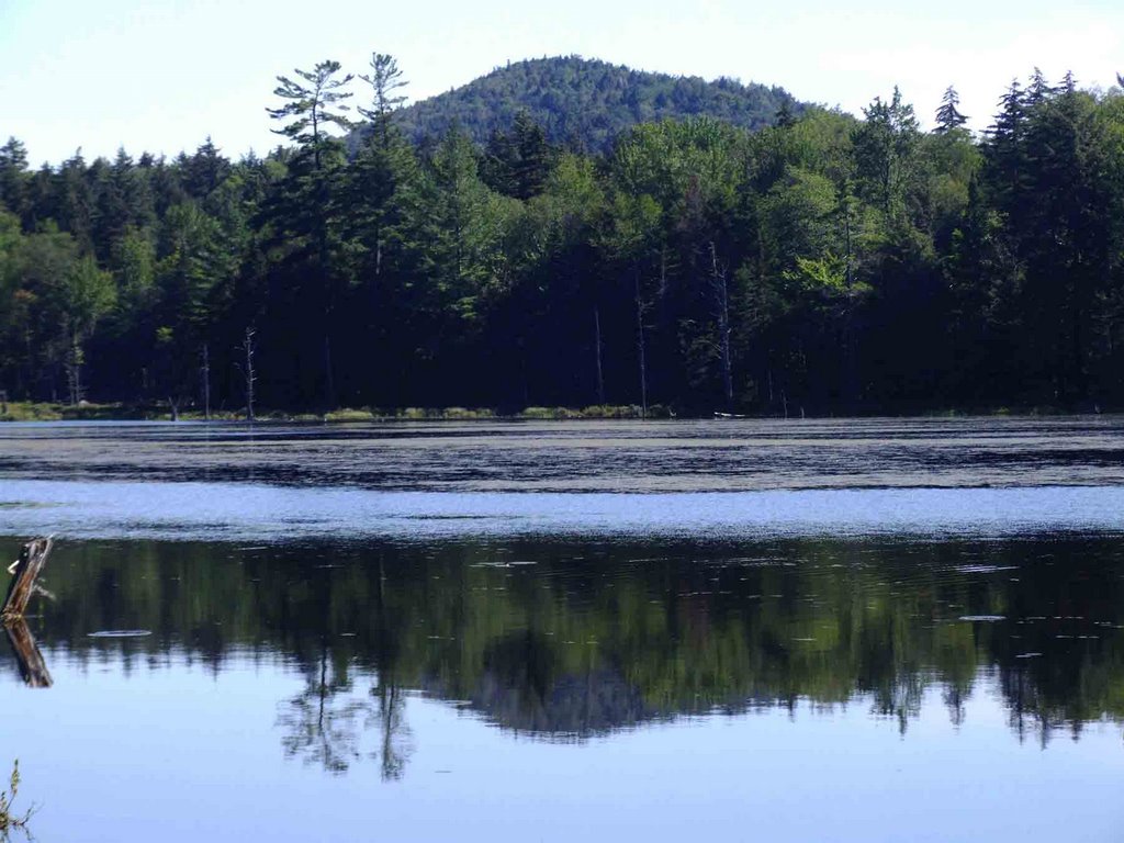
In these two photos, which were taken from the NorthWest shore of Pharaoh Lake, you can see No. 8 Mountain in the distance.

After coming down this trail and enjoying the shore of Pharaoh Lake, I decided that rather than follow the Glidden trail back I would hike over Pharaoh Mountain to return to the trailhead. On paper it only added a bit over a mile of hiking, so at the time it seemed like a reasonable idea. The climb up to the South side of Pharaoh Mountain was more than I expected, and even included a couple of short scrambles up rock walls in order to follow the trail. It took me a bit over an hour to get to the highest point of trail a the top of the mountain, which my gps showed as an elevation of 2408. I did not go the last 100 feet to the top, rather, saving my energy for the rest of the trip. It was just as well, a few minutes later there were rumbles of thunder off to the West. Going down the North side of Pharaoh Mountain you encounter areas of smooth, often wet, rock where much care needs to be taken to avoid slipping. It took me far longer than I had anticipated going down the first 3rd of the mountain because of this. Once you get down this rocky section, the trail is very pleasant with lots of pine and wide open areas covered with needles, again, more "pure Adirondack" scenes to enjoy along the way.

The hike back to the trailhead was uneventful, having gone 14.5 miles in a bit over 7 hours. Even if you only hiked in the Blue Hill Trail to Crane Pond, this area is well worth visiting, I know I will be going back again in the near future.
Dave

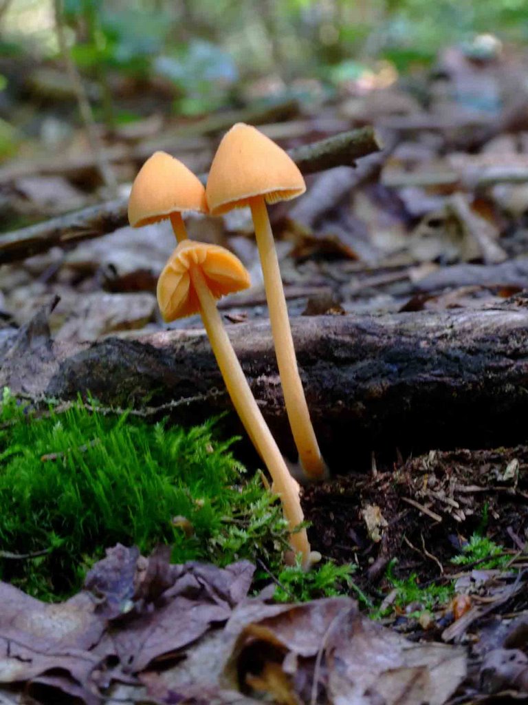 I think these are Orange Mycenas